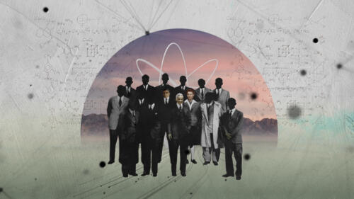
World War II
It was the biggest and deadliest war in history, spanning six grueling years and involving countries in nearly every part of the world. Sparked by the 1939 Nazi invasion of Poland, World War II pitted the Allied forces (led by the United States, Great Britain and the U.S.S.R.) against the Axis powers (Nazi Germany, Japan and Italy). Explore the battles, key players and atrocities from the war and its impact on geopolitics and humankind today.
Featured Overview
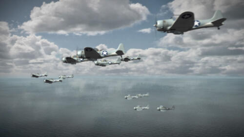
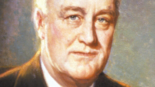
After the bombing of Pearl Harbor on December 7, 1941, President Franklin Roosevelt committed American forces to the Allied cause.

Featured Overview
After the bombing of Pearl Harbor on December 7, 1941, President Franklin Roosevelt committed American forces to the Allied cause.
Start Here

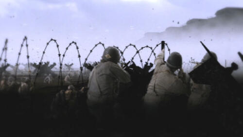
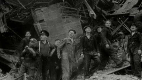
Adolf Hitler’s invasion of Poland in September 1939 drove Great Britain and France to declare war on Germany, marking the beginning of World War II. Over the next six years, the conflict took more lives and destroyed more land and property around the globe than any previous war. See a timeline of the war's battles.

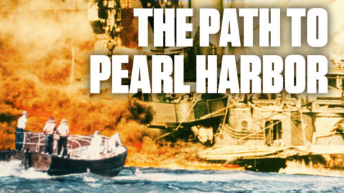
By the time the first Japanese bomber appeared over Pearl Harbor on December 7, 1941, tensions between Japan and the United States had been mounting for the better part of a decade, making war seem inevitable.

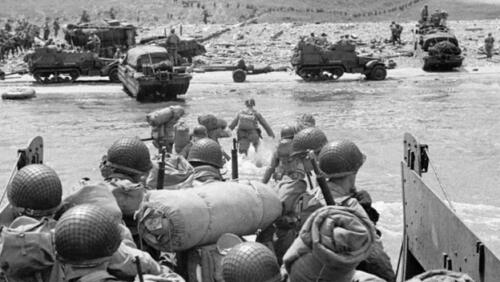
The Allied invasion of Normandy was among the largest military operations ever staged.

The Holocaust was the persecution and murder of millions of Jews, Romani people, political dissidents and homosexuals by the German Nazi regime from 1933-1945.
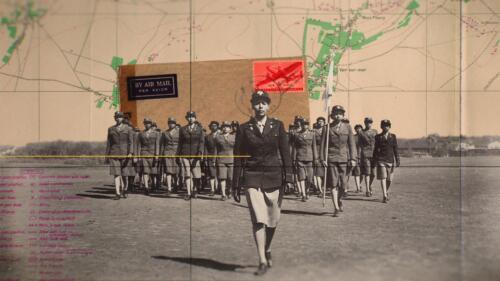
The Hidden Army of Women That Helped Defeat Hitler
Flashback: The Hidden Army of Women That Helped Defeat Hitler
This 1944 American propaganda film imagine’s Hitler’s surrender and explains the Füher’s greatest mistake – his underestimation of American women. This episode of Flashback shows how female wartime workers were an indispensable part of America’s victory, even before the war was officially won.
2:46 watch

3 Key Battles


Explore All Related Topics

Mexican American teen Guy Gabaldon used words, not bullets.

They provided strategic bases and fought with Allies in Italy.
With Europe under Nazi rule and Britain low on funds, Roosevelt and Churchill met in secret to strike a bold wartime agreement.

The 'plan B' drop site that day, it was almost spared.

Military strategists weaponize fear, confusion and deception.
Allied forces uncover valuable artworks and other treasures hidden by Nazi Germany, but one piece in particular has a more symbolic meaning.
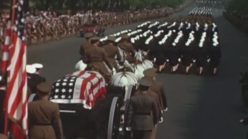
The end of World War II was one of the most celebrated moments in 20th-century history—and is marked by multiple historic days.

Part superhero, part supersalesman, he became a potent symbol.

Rare amber panels from this 'Eighth Wonder of the World' were lost to history amid Nazi looting.
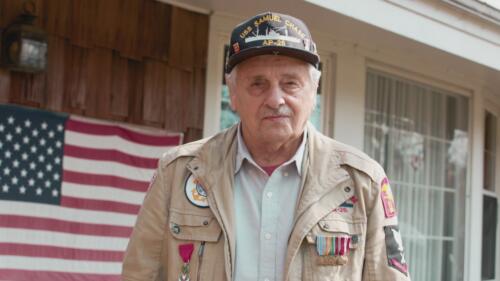
Frank DeVita was in charge of lowering the ramp on the USS Samuel Chase on D-Day. The role would haunt him for the rest of his life.

Flexing of military muscle is a longstanding tradition.

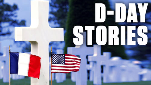
A small unit of African American soldiers buried thousands of Americans killed in combat in Europe.

Amid the search for enemy submarines, Navy researchers detected something much bigger.
855 Black women of the 6888th Postal Battalion delivered mail in WWII, breaking racial and gender barriers in the military.

Eighty years ago, people across the allied nations rejoiced in the defeat of Hitler and the Nazis with mass parades and celebrations.

Learn why the holiday is so significant in Russia—and what distinguishes it from V-E Day.
The 761st Tank Battalion was the first all-Black tank squad to see combat during World War II.
The 761st Tank Battalion receive new orders.
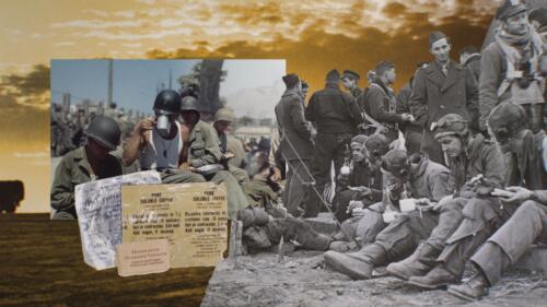
The War Department considered coffee an essential element to the troops' diet.
The most ambitious amphibious invasion in history begins as the Allies launch a high-stakes attack of Nazi-occupied France to win the war.

The Allies launched this high stakes attack in order to win the war.
The Japanese deploy deadly kamikazes in an effort to destroy the USS Laffy.

Rodger Bushell plots his escape from the most notorious Nazi prison camp of WWII.
As fighting continues in the Pacific, The U.S. Navy begins night raids on Japan's island territories unleashing a punishing assault that will signal the end of WWII in the pacific.
In WWII, FDR spends years preparing for the "day of days" when Allied forced invade Normandy.
FDR passed away shortly after the Yalta conference. See more in Season 1, Episode 3, "Arsenal of Democracy."

Raising two fingers in a 'V' shifted in meaning from 'Victory' to 'Peace.' Track the change from World War II to the Vietnam War eras.

From the Civil War to the rule of Ferdinand Marcos in the Philippines, find out how martial law has been enforced—and exploited.
Discover the remarkable story of D-Day, where Allied forces broke through the formidable Atlantic Wall during the Normandy invasion.
Explore the intense and harrowing Battle of Caen, a pivotal clash during World War II.

As Hitler bombed London, its citizens set up makeshift beds in rail cars, on escalators and even in tunnels to get a night's sleep.

Operation Pied Piper organized the evacuation of some 800,000 children from urban centers in anticipation of Nazi bombings.

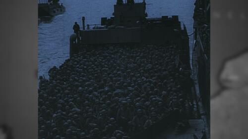
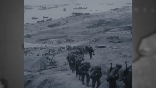
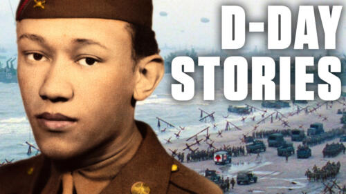
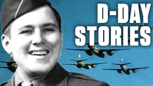
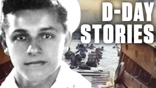
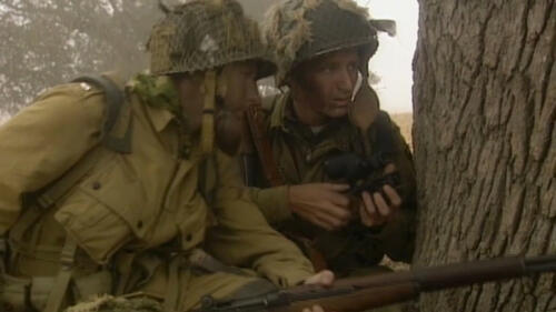
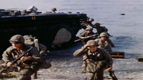
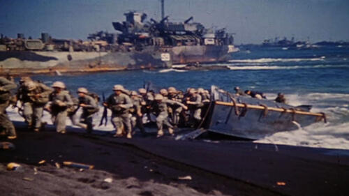
On June 6, 1944, more than 156,000 American, British and Canadian troops executed the largest amphibious landing in history. Five veterans share their stories from that day.

From dead rats implanted with bombs, to a giant explosive wheel, these World War II weapons were creative, but not very successful.
The Tuskeegee Airmen were a group of pilots who overcame racism and prejudice, becoming decorated war heroes of WWII.
American fighter pilots take on the Japanese in a grueling fight for control of Guadalcanal.

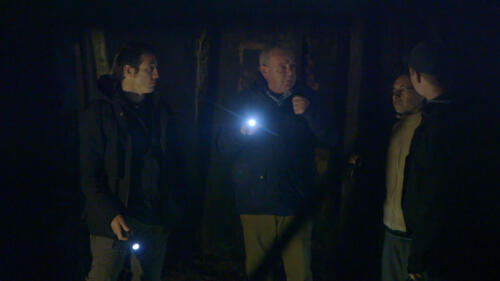
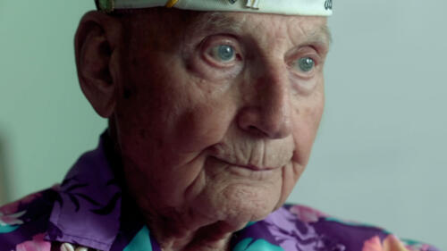
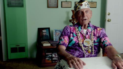
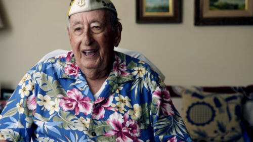
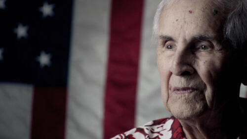
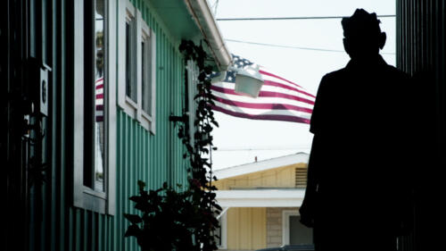
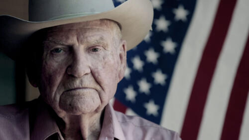
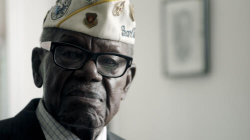
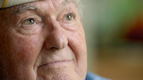
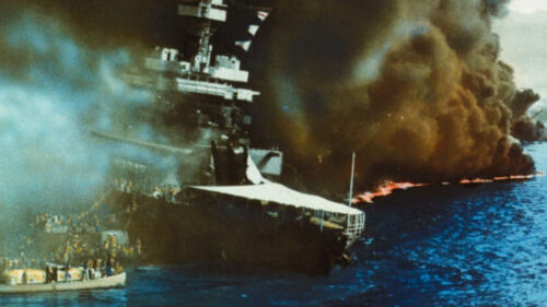
On December 7, 1941, a surprise Japanese attack on Pearl Harbor shocked America. These are the stories of veterans who were at the naval base that morning.
FDR asks Congress to declare war on Japan in response to the attack on Pearl Harbor during World War II.

Roosevelt green-lit the Manhattan Project in response to fears that Nazi Germany might build a bomb first.

The first lady did what she could to support Japanese Americans during WWII—without appearing to defy FDR's Executive Order 9066.

On that infamous December day in 1941, Japan also attacked Guam, the Philippines, Hong Kong, Singapore and Malaya.

The ascendance of plastics and television forever changed the industry.

The Office of Malaria Control in War Areas sought to curb malaria transmission in the United States.

As survivors of history’s only atomic bomb attacks, they made it a mission to warn the world about the horrors of nuclear war.

During WWII and beyond, blue ticket discharges carried powerful stigma—and serious negative consequences.

As members of the Ritchie Boys, German and Austrian refugees offered language skills and knowledge that proved vital to American military intelligence.

Neutrality was often more complex than simply avoiding choosing sides.
Theo Wilson time-travels to the Battle of Stalingrad in 1942 where the underdog Russian Army is about to pull off a victory that will turn the tide of the war in favor of Allied forces.

Mussolini, who coined the term fascism, crushed opposition with violence and projected an image of himself as a powerful, indispensable leader.

For centuries—and especially since World War II—countries have attempted to define the rules of war and determine punishment for violators.

The “Ghost Army” used creative tricks such as inflatable tanks and sound effects to dupe German forces.

The Nazis thought the Stalag Luft III camp was escape-proof, but 76 Allied airmen proved them wrong.

Fireside Chats. The 'Fight of the Century.' A live report from Pearl Harbor. These are just a few of the historic radio broadcasts that seemed to have the whole nation listening.

Motorcycle groups offered brotherhood and adventure for returning GIs, many of whom were still processing the horrors of war.

The tennis club's center court even took a direct hit from a 500-pound German bomb.
Some of the brightest American minds were called to work on the Manhattan Project, including a number of Black scientists and engineers.

At least 12 Black chemists and physicists worked as primary researchers on the team that developed the technology behind the atomic bomb.

Federally-subsidized childcare centers took care of an estimated 550,000 to 600,000 children while their mothers worked wartime jobs.
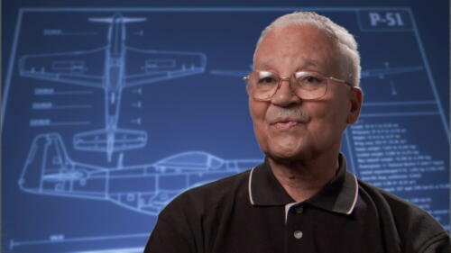
Charles Norman Shay's heroics at D-Day are etched into history, and his perspective as a Native American makes his story all the more important.
Under the cover of darkness, the Allies pulled off an operation in the hours before D-Day that may have changed the tide of the battle before it had begun.
Adolf Hitler’s invasion of Poland in September 1939 drove Great Britain and France to declare war on Germany, marking the beginning of World War II. Over the next six years, the conflict took more lives and destroyed more land and property around the globe than any previous war. See a timeline of the war's battles.
Learn more about the history of D-Day.
The United States' decision to use the atomic bomb was made after great debate, but still led to a massive loss of human life.

Radar, computers, penicillin and more all came out of development during the Second World War.

Elizebeth Friedman’s codebreaking helped save the Queen Mary and capture a Nazi spy ringleader in Latin America.

Looking beyond traditional nursing or clerical roles, some women served as snipers, bomber pilots and more.

These pioneering Black aviators not only took on the Germans; they shattered racist stereotypes and helped advance civil rights.

Explore five defining events that led to the conclusion of World War II on September 2, 1945.
Before the 1945 atomic blasts, they were thriving cities. In a flash, they became desolate wastelands.

The explicit reason was to swiftly end the war with Japan. But it was also intended to send a message to the Soviets.

U.S. airmen were awarded five Medals of Honor for Operation Tidal Wave, a risky, low-flying bombing mission.

The campaign used fake news to shift U.S. opinion about going to war with Germany.

Tomoyuki Yamashita and the Führer had their own separate agendas. Later, they would share a mutual interest in gold.

After being hit by a Japanese suicide plane, the crew of the USS Comfort were forced to tend to their own.

Human fossils, an amber room and a Raphael masterpiece all went missing during WWII.

America's largest industry shifted from making cars to bombers, tanks and more—at unparalleled speed.
Iby Knill was taken to Auschwitz on the day she was meant to be married. She describes what life was like for her before the rise of the Nazi party and how they came to power.

At the Battle of Leyte Gulf, the Japanese Navy catches the American landing forces are caught by surprise. Outgunned, the Americans stage a daring defense.

The Battle of Leyte was an amphibious invasion that launched the beginning of the recapture and liberation of the entire Philippines after almost three years of Japanese occupation in this clip from "Battle of Leyte Gulf."

The punishing three-day Allied bombing attack, intended to force a German surrender, leveled the city and left tens of thousands dead.
Faced with the harsh terrain of the European Alps, American soldiers didn't back down – they just hit the slopes.

'After Auschwitz, the human condition is no longer the same. After Auschwitz, nothing will ever be the same.' —Elie Wiesel.

Estimates suggest that Nazis murdered 85 percent of the people at Auschwitz. Here are the stories of three who survived.

The USS Enterprise, or The Big E, was the most decorated U.S. ship of WWII and was outfitted with some of the most advanced technology of the age.
In November, 1943, the USS Enterprise supports a two pronged attack in the Pacific at the WW2 Battle of Tarawa.
On Friday the 13th, 1942, the US Navy clashed with Imperial Japanese forces in the Naval Battle of Guadalcanal. The conflict led to the destruction of ships on both sides, but ended in a strategic US victory.
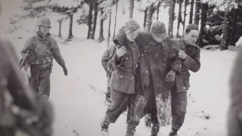
Facing the harsh conditions of the European winter, American soldiers fighting in the Battle of the Bulge faced a challenge like no other.

Under cripplingly cold winter conditions, American troops proved their mettle.

The mighty clash between Japanese and U.S. naval forces in June 1942 ended in a stunning—and surprising—Allied victory.
Historian and author Don Miller discusses how one WWII battle before Thanksgiving would affect the homefront.

Advanced intelligence helped the Allies turn the tables on Japan in this crucial World War II naval battle.

Ralph Lazo wasn’t of Japanese descent, but he spent spent two years at Manzanar in solidarity with his friends.

From a trove of Fabergé eggs to Nazi-stolen gold dumped in a lake, these supposedly missing stashes have captured the imagination of explorers the world over. But are they the stuff of fantasy?

It was a daring and massive offensive into the Nazi-occupied Netherlands that ultimately became a costly failure.

The fire prevention icon was born of national paranoia about enemy-initiated wildfires.

Fed up with Hitler, though only partially for moral reasons, high-level German resisters nearly succeeded in assassinating him in July 1944.

The sweeping bill promised prosperity to veterans. So why didn’t Black Americans benefit?

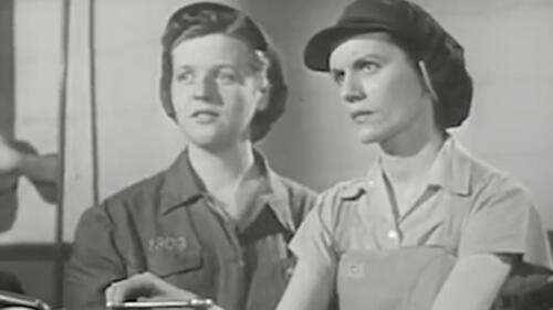
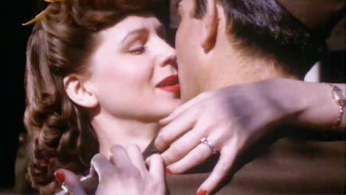
Embodying patriotism and strength, American women stepped into roles once closed off to them to support the war efforts on the home front and abroad.

This multimedia journey tells the story of June 6, 1944, and the unlikely triumph at Normandy that would go down in history.
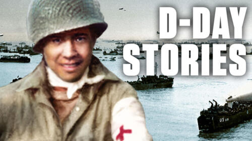
Waverly Woodson Jr., was a medic on D-Day in the only all-black battalion to storm the beach. He worked for over 30 hours straight saving lives while he himself was wounded.
Guy Whidden was one of the first to parachute into Normandy on D-Day. A moment of divine intervention would save his life.
Frank DeVita was in charge of lowering the ramp on the USS Samuel Chase on D-Day. The role would haunt him for the rest of his life.
Native elder Charles Norman Shay was a combat medic with 1st Infantry or “The Big Red One” – one of the first units to land ashore on Omaha Beach on D-Day. It was his very first day of combat in his life.
Survivors share how D-Day changed their lives forever.

When the Nazis occupied France, five-year-old Bernard Marie believed every man in uniform was a bad guy. The D-Day invasion changed all that.

Waverly Woodson treated at least 200 injured men on D-Day, despite being injured, himself.

Allied military leaders knew that casualties could be staggeringly high. Historians are still calculating the toll.

Eichmann, a chief mastermind of the Holocaust, escaped to South America after World War II. Israel's secret service was determined to root him out—and make him pay.

First came the diamond-filled golden Buddha and the box of gold bars. Then came the torture.

Kurt Gerstein's official mission: ‘improve the service of our gas chambers.’ His personal mission: opportunistic sabotage.

Anticipating the Allied arrival, German researchers hid their files inside a watertight drum and sunk it into a cesspool.

After 77 years, the exact location of the World War II stinger has been discovered.

Over 600,000 'enemy aliens' were singled out during the early days of the war.

Marcel Marceau saved at least 70 Jewish children from the Nazis through risky border crossings during World War II, and his cousin Georges Loinger saved 350.

Declassified files suggest that before bombs fell in the day of “infamy,” Harry Dexter White helped set the wheels of war in motion. But did he?
How did things get so bad between the US and Japan in the lead up to WWII? It all comes down to power and resources.

On the morning of December 7, 1941 Paul Kennedy found himself staring straight at an incoming Japanese aircraft.

Not until nearly three years after the bombing of Pearl Harbor did Japan adopt suicide aerial attacks as official military strategy.

The surprise Japanese assault inflicted heavy losses but failed to strike a decisive blow.

The war had turned forestry work into a form of civil defense, and prisoners a new army on the home front.
D-Day is one of the most widely known battles in WWII, but it almost didn't happen. Here's Why.

Soldiers and civilians let out a collective sigh of relief—and then celebrated—after Germany's and then Japan's surrender.
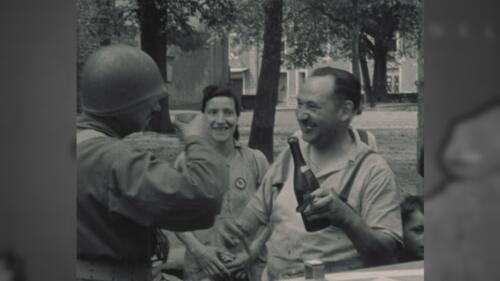
After 70 years, Joshua Kaufman reunites with Daniel Gillespie, who helped liberate him from Dachau.
Liberators and survivors return together to the notorious Nazi concentration camp seven decades later.

The Allies had won the war, but thousands of U.S. troops were fed up.

Joachim Ronneberg was humble about the almost suicidal operation he led at age 23.

As the U.S. sent troops to the front lines, artists were recruited to encourage those at home to do their part.

Many Allied bombings released the equivalent energy of 300 lightning strikes and temporarily weakened the ionosphere, say researchers.

The drawings were in the stash of Hildebrand Gurlitt, the head buyer for Adolf Hitler’s planned Führermuseum.

While the war raged overseas, soldiers and civilians worked furiously to protect the capital against rising waters.

The party began after Japan officially surrendered, and included a very iconic kiss.

The U.S. occupation of the Ogasawara, or Bonin, Islands was anything but simple.
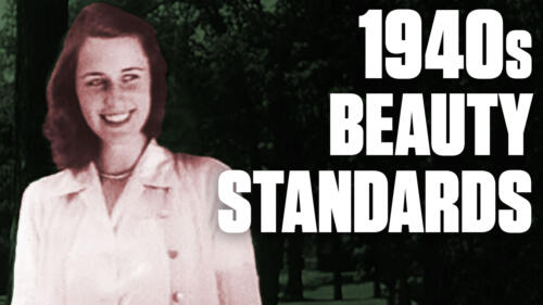
After the end of World War II, society expected women to return to the subservient roles they held before the war. Proper dress and pristine hygiene became paramount concerns, and as this 1948 film demonstrates, the expectations were quite high.

The message had been carved into the ground along Ireland's coast and was revealed as the fire scorched undergrowth.

In preparation for war, Hitler wanted to find substitutes for fat-based products—including margarine—in case imported sources were cut off.

'There were a lot of sharks,' says a survivor.

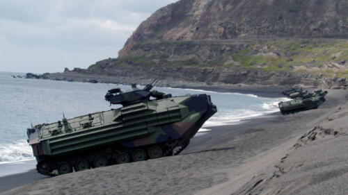
The vehicles could deliver supplies from ship to shore, but couldn’t cut it in rough waters.

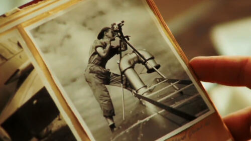
Getting the perfect shot in wartime is not only about weapons. Photographers were there every step of the way to capture the heroic triumphs and devastating losses.

How did women's service during World War II inspire their fight for social change and equality?

Chief Justice Roberts wrote in a court decision that 'Korematsu was gravely wrong the day it was decided,' but that didn’t overrule the 1944 decision endorsing Japanese internment.
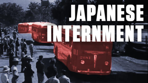
The internment of Japanese Americans began after President Roosevelt signed Executive Order 9066 in February 1942. For the following three years, American men, women, and children were forced to live under prison-like conditions in remote concentration camps. This 1943 film explains the internment from the U.S. government's perspective.

Austria’s national squad had been known as the 'Wunderteam,' but when conscripted to play for Germany, they were less impressive.

As the war dragged on, creator Anthony Pratt longed for the fun of English country-estate murder-mystery parties, where guests would skulk the hallways, shriek and fall ‘dead’ on the floor.

An actual soldier named Fritz Niland was targeted to be saved by a U.S. War Department 'sole-survivor' directive designed to keep families from losing all of their sons.
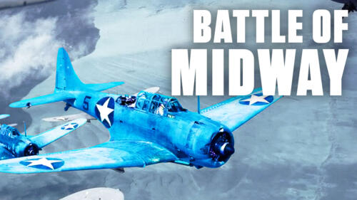
Seven months after the attack on Pearl Harbor, American and Japanese forces clashed over Midway Atoll, a dot of land in the middle of the Pacific Ocean. The Battle of Midway tested intelligence and combat capabilities on both sides – while decidedly altering the outcome of World War II.

Over 240 men and women volunteered for what might have seemed to be a suicidal mission.

British intelligence called Juan Pujiol Garcia 'Agent Garbo' because he was so good at assuming new identities.
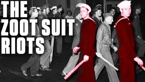
Learn how media bias and anti-Mexican racism contributed to the Zoot Suit Riots in Los Angeles in 1943.

Virginia Hall, a.k.a. the ‘Limping Lady,’ organized sabotage and rescue operations across Vichy France, paving the way for the Allied invasion.

An analysis of Adolf Hitler's teeth and bones puts to rest questions of how he died.

Historically, crocodile attacks are 100 times deadlier than shark attacks—and far more frequent—ranging from harrowing individual confrontations to a mass attack on World War II soldiers.

The Allied invasion of June 6, 1944 was one of the biggest and most significant military campaigns in history.

The War Department commissioned the creme de la creme of Hollywood, including Dr. Seuss and Mel Blanc, to create the 'Private Snafu' film franchise.

The Ringelblum Archive was saved just one day before the Warsaw Ghetto Uprising.
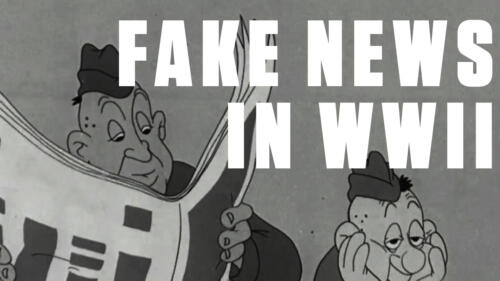
Fake news isn’t new news. During WWII, military bases were breeding grounds for false reports and gossip. In this cartoon, part of a series created for the armed forces by Theodor Geisel (a.k.a. Dr. Seuss) and the folks behind Looney Tunes, “Private Snafu” learns the dangers of spreading rumors the hard way.
By the time the first Japanese bomber appeared over Pearl Harbor on December 7, 1941, tensions between Japan and the United States had been mounting for the better part of a decade, making war seem inevitable.

The Los Alamos Historical Museum halted a Japanese exhibition on the bombings of Hiroshima and Nagasaki because of a controversy over its message of abolishing nuclear weapons.

Dozens of government-funded films were created, and their impact went well beyond recruiting soldiers to the frontlines.
This 1944 American propaganda film imagine’s Hitler’s surrender and explains the Füher’s greatest mistake – his underestimation of American women. This episode of Flashback shows how female wartime workers were an indispensable part of America’s victory, even before the war was officially won.

Germany settled its war debts decades ago. So why do Polish officials want more?
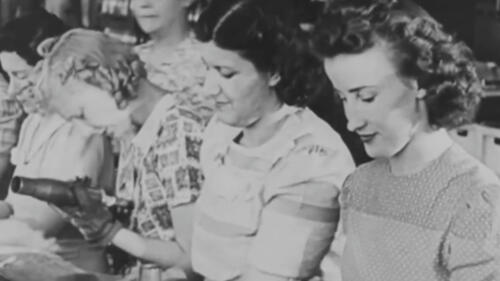
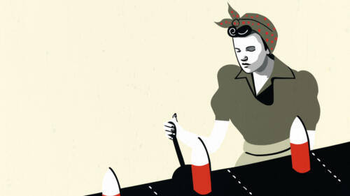
A lack of labor supply during World War II forced women into industrial jobs. This Flashback highlights the "problems" female workers faced in a new and unfamiliar environment – reflective of a less enlightened time.

Stanislawa Leszczyńska was instructed to murder babies, but refused. She is a candidate for sainthood in the Catholic church.

When women were asked to sign on to factories, they responded in droves. Unfortunately, this caused new "problems" for men, who had no idea how to interact with them in the workplace.

Using the term 'Polish death camp' is now punishable by up to three years in prison.

Where is Dunkirk? Dunkirk is located in the north of France, on the shores of the North Sea near the Belgian-French border. The Strait of Dover, where the distance between England and France is just 21 miles across the English Channel, is located to the...

Naomi Parker Fraley, the inspiration behind Rosie the Riveter, died in January 2018.

In some cases, it took four or five decades to bring them to justice.

They literally tried to take the Christ out of Christmas.

Hitler’s war against Boy Scouts fueled the Third Reich’s ideology—and its military might.

What it was like to be a sailor during the Pearl Harbor attack.

Starving Soviets couldn’t resist the smell of Finnish cooking.

The Geneva Convention, initially held in 1864, sparked a series of international agreements regarding the humane treatment of prisoners of war.

Though German Jewish teenager Anne Frank did not survive the Holocaust, the memoirs from her two years in hiding live on forever.
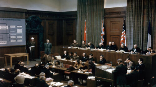
In 1945 and 1946, Nazi war criminals were forced to account for their depraved actions in the city of Nuremberg, Germany.

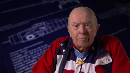
How Hershel 'Woody' Williams used his flamethrowing prowess to become an American hero.

The country's military is disobedient by design.
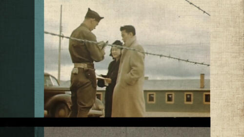
After the attack on Pearl Harbor, the United States Government issued executive order 9066, which empowered the military to round up anyone of Japanese ancestry and place them in internment camps.

The Zoot Suit Riots of 1943 were violent clashes in which U.S. servicemen, police officers and civilians brutalized Latinos and other minorities in Los Angeles.
The Lend-Lease Act was a compromise that allowed the United States to provide aid to England while avoiding full involvement in World War II.
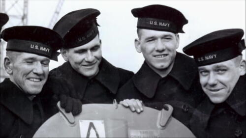
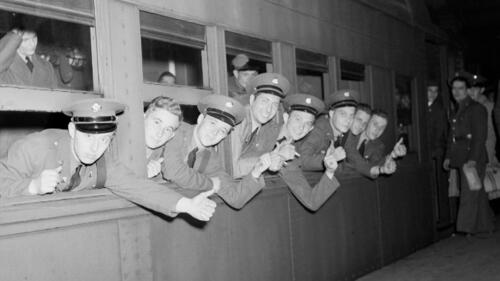
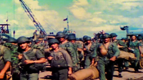
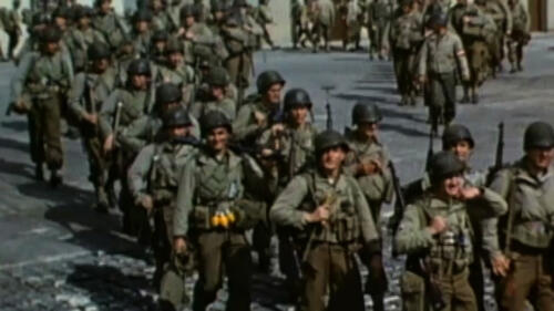
It was all hands on deck as Americans pitched into a second World War effort after the attack on Pearl Harbor in 1941.
The Marshall Plan was an example of "good deed foreign policy" designed to rebuild Western European economies in the wake of WWII.

The atomic bomb and nuclear bombs, powerful weapons that use nuclear reactions as their source of explosive energy, are regulated by international agreements.

Computer programming used to be a ‘pink ghetto’—so it was underpaid and undervalued.

The loss of USS Indianapolis was famously memorialized in the movie "Jaws."

After leading development of the first atomic bomb, J. Robert Oppenheimer called for international controls on nuclear weapons. It cost him his job.

The agencies leading up to the Manhattan Project were first formed in 1939 by President Franklin D. Roosevelt after U.S. intelligence operatives reported that scientists working for Adolf Hitler were already working on a nuclear weapon.

A massive cache of original Nazi artifacts—including a photo of Adolf Hitler and a ghoulish cranial-measurement device—was found in a secret room in a Buenos Aires suburb.
The team tours the Bremer's family home.

Even before the US entered World War II, German military intelligence had developed a plan to secretly infiltrate the East Coast and sabotage American war efforts.

Countless history books, TV documentaries and feature films made about World War II, many accept a similar narrative of the war in the West, which may not be entirely accurate.

The fiasco was initially covered up to ensure the D-Day mission remained secret.

The atomic bomb made its national tv debut in 1952.

A new book delves into the real story of how the Allies confronted the Holocaust.

A little more than four months after the Japanese bombing of Pearl Harbor, the United States struck back on April 18, 1942, with the daring Doolittle Raid.

After relic hunter Dan Mackay discovered 14,000 dog tags mysteriously buried in a field outside London, he set out on a quest to reunite the artifacts with the families of the British soldiers who were meant to wear them.

During the Holocaust, Jewish photographer Henryk Ross used his camera as a tool of resistance against the Nazi regime by documenting the harsh realities inside the ghetto of Lodz, Poland.

On February 25, 1942, an infamous false alarm saw American military units unleash a torrent of anti-aircraft fire in the skies over Los Angeles.

Actor George Takei reflects on a lifetime of activism, the legacy of Japanese American incarceration camps and the spirit of 'gaman.'

Convicted of treason for her infamous “Tokyo Rose” propaganda broadcasts during World War II, American Iva Toguri eventually spent nearly three decades waiting for her name to be cleared.

Introduced in 1941, the strong, courageous and feminine new superhero had both pin-up girl looks and Rosie the Riveter spirit.

Hours before enemy planes filled the skies above Pearl Harbor, Japanese midget submarines were already lurking below water in a little-known aspect of the attack.

After the attack on Pearl Harbor, the U.S. government undertook a secret operation to hide the Constitution, Declaration of Independence and other treasured American artifacts.

The Japanese attack caught the U.S. Navy off guard but ultimately failed to cripple its war effort at sea, thanks to a massive salvage effort that began almost as soon as the smoke cleared.
Though blindsided by the attack, Pearl Harbor fighters made a valiant effort to combat the first wave of Japanese planes.
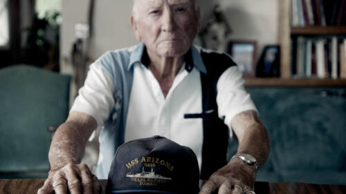
Pearl Harbor survivors give first-hand accounts of the fiery destruction of battleships like the USS Arizona, USS West Virginia, and USS Oklahoma.

During the attack on Pearl Harbor, U.S. pilots George Welch and Kenneth Taylor managed to get airborne under fire—twice—and shot down at least six Japanese planes between them.
In the days immediately following the attack on Pearl Harbor, the American homefront quickly mobilized to support the war effort.

Pearl Harbor veterans talk about where they were and how they felt when Japan surrendered on September 2, 1945.
As American servicemen prepared for a bloody battle in the Pacific, an unprecedented event would change the course of WWII.
Veterans of Pearl Harbor describe the personal circumstances that led them to enlist in the Navy.
Pearl Harbor survivors share the valuable lessons that future generations can take away from the attacks.
A look back at the intelligence failures and oversights that led to the successful Japanese attack on Pearl Harbor in 1941.
Though blindsided by the attack, Pearl Harbor fighters made a valiant effort to combat the first wave of Japanese planes.
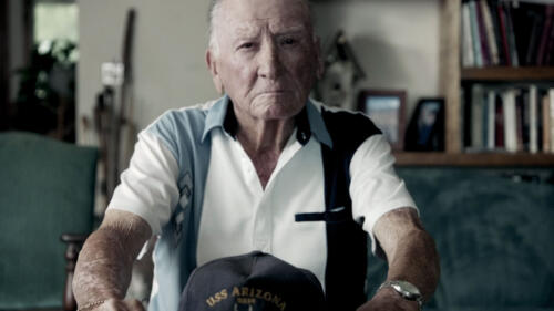
Pearl Harbor survivors give first-hand accounts of the fiery destruction of battleships like the USS Arizona, USS West Virginia, and USS Oklahoma.
Pearl Harbor survivors describe the attack's harrowing first moments on the morning of December 7, 1941.
The Pearl Harbor attack caused a wave of nationalist resentment that had long-reaching effects on the Japanese-American population.

An explosive bestseller mined the records of Adolf Hitler’s personal doctor, among other sources, to uncover details of the long-rumored drug use by many in the Nazi regime.

By 1945, sales of “Mein Kampf” topped 10 million copies and the royalties had made the dictator rich.
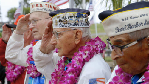
In honor of Veterans Day, survivors of the 1941 Pearl Harbor attacks share their insight on war, sacrifice, and remembering their fallen comrades.
On September 7, 1940, 300 German bombers raided London in what would be the first of 57 consecutive nights of bombing. This "blitzkrieg" would continue until May 1941.
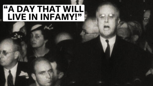
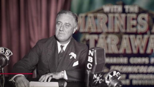
After the sudden and deliberate attack on Pearl Harbor by the Japanese during World War II, President Roosevelt spoke to Congress and the American people.
Learn more about the Battle of Guadalcanal, the Allies' first major offensive - and a decisive victory - in the Pacific theater during World War II.
Six months after the attack on Pearl Harbor, the United States defeated Japan in one of the most decisive naval battles of World War II. Learn more about the Battle of Midway.

The post-World War II trials marked the first-ever prosecutions for genocide and crimes against humanity.

Newly declassified files have revealed how one of Britain’s greatest double agent’s marital troubles threatened his cover and could have altered the course of World War II.
Take a look at key events that led to the Nazi party's rise to power in Germany.

When German forces closed in around the Soviet city of Leningrad in September 1941, a siege began that would last nearly 900 days and claim the lives of 800,000 civilians.

Meet the history teacher-turned-Resistance heroine who outwitted the Gestapo and rescued her husband (more than once) from captivity.

On April 30, 2019, Akihito became the first ruler to abdicate the Chrysanthemum Throne in two centuries. His son Naruhito succeeded him.

Look back at one of the most epic nautical chases and battles in naval history, the sinking of the mighty Nazi battleship Bismarck.

Battling pernicious racial stereotypes about their fitness for combat, the Tuskegee Airmen more than proved their skill and valor in World War II.

Explore the children’s author’s little-known work penning political cartoons and producing propaganda films during World War II.
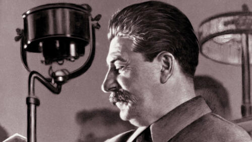
Joseph Stalin's forced industrialization of the Soviet Union caused the worst man-made famine in history. Find out more about his life and rise to power in this video.

From the Army’s Green Berets to Navy SEALs, Air Force Air Commandos, Marine Corps Raiders and beyond, Special Ops forces are the elite of the U.S. military.

From the man who led the evacuation of USS Arizona to the fighter pilot who took to the skies in his pajamas, learn the stories of eight of the many servicemen who distinguished themselves on one of the darkest days in American military history.

Hostility toward minority communities fueled the L.A. Zoot Suit riots during the wartime summer of 1943.

A decision to add Anne Frank’s father as a co-author on her famous diary in order to extend its European copyright is stirring considerable controversy.

Despite ongoing efforts to bring them to justice, many former Nazis have avoided prosecution for their role in the Holocaust, as well as other wartime atrocities.

In order to prevent enemy sabotage at home during World War II, the U.S. government secretly enlisted the help of an unlikely partner.

Talk about 'death by chocolate.' Drawings reveal Nazi booby traps made from everyday items, including a chocolate bomb meant for the British Prime Minister.

Some 260,000 people survived the atomic bomb attacks on Hiroshima and Nagasaki—Tsutomu Yamaguchi was one of the very few who endured the horror of both.

The battle was the first to be fought solely in the air—and it decided the fate of Great Britain during World War II.

The nearly three-month battle for Okinawa was the last—and the bloodiest—clash between Japanese and U.S. forces in the Pacific during World War II.

Japan’s bizarre WWII plan to bomb the continental U.S. by high-altitude balloons claimed its first and only victims—an Oregon church group in 1945.

From a beer hall skirmish to a conspiracy by a cabal of Nazi dissidents, learn the stories behind six assassins who nearly succeeded in killing Hitler.

How did Italy's wartime dictator die? And what happened to his corpse afterward?

After an eight-year search, a research team sponsored by Microsoft co-founder Paul Allen has discovered the shipwreck of the massive Japanese battleship Musashi.
A look back at one of the most hard-fought battles of World War II.

The 19-year-old U.S. soldier personally killed or wounded some 50 German troops, earning the Medal of Honor for one of WWII's most astonishing battlefield actions.

Learn about six fascinating double agents, from the FBI counterspy who brought down a major espionage ring in the United States to the operative who fooled the Nazis about D-Day.

Learn eight fascinating facts about one of the most celebrated American servicemen of World War II.

Winston Churchill called it 'undoubtedly the greatest American battle' of World War II.

From baseball player Moe Berg to “Charlie and the Chocolate Factory” author Roald Dahl, learn about six famous people who once were wartime secret agents.

On the 70th anniversary of his death get the facts on the famed “Desert Fox.”

Newly released WWII files confirm the existence of a legendary seductive spy and reveal more about one of Britain’s most notorious traitors.

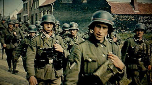
The Nazi offensive began with a bang—many of them—and led to a global conflict that would span six years.

In search of a lightweight, nutritious and high-energy snack for soldiers, the U.S. Army turned to Hershey. The results weren't exactly a sweet treat.

Get the facts on five D-Day beaches—code-named Utah, Omaha, Gold, Juno and Sword—that the Allies invaded.
The massive Normandy landings required optimal weather conditions. That wasn't the case on June 5, the original chosen day of attack.

The sophisticated hoax fooled the Nazis and laid the groundwork for the Normandy invasion.

The meaning behind the "D" in D-Day has to do with military terminology.
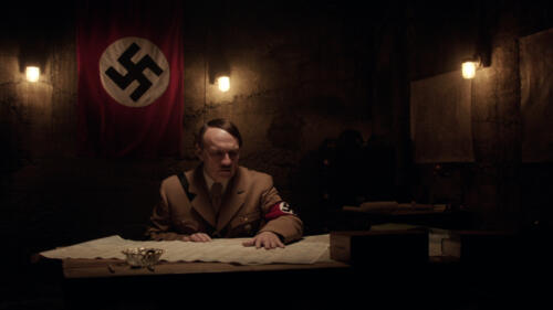
In this scene, Hitler comes to the realization that this is the end as the Allies successfully invade Europe and continue to liberate territories.

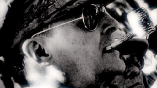
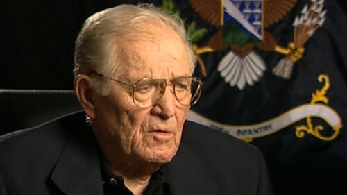
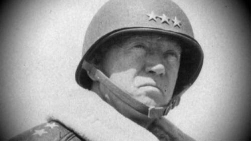
Learn 10 surprising facts about the outspoken American general who fought in both World Wars.
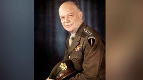
Mini-biography on the life of Dwight D. Eisenhower.

Explore 10 surprising facts about the controversial five-star American general who fought in two World Wars and Korea.
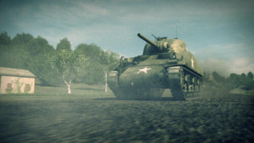
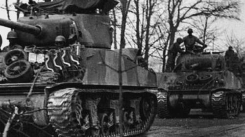
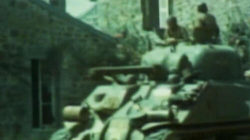
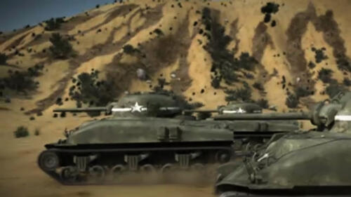
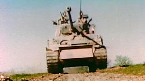
With almost 50,000 manufactured during World War II, the M4 medium tank, popularly known as the "Sherman," provided critical armored support to Allied ground troops.
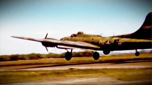
Known as the “Flying Fortress,” the B-17 was the backbone of the United States’ aerial forces during World War II. Get all the facts and figures.
After the bombing of Pearl Harbor on December 7, 1941, President Franklin Roosevelt committed American forces to the Allied cause.

Meet six of history's most fascinating rogue military leaders.

On September 30, 1938, British Prime Minister Neville Chamberlain received a rowdy homecoming after signing a peace pact with Nazi Germany.

Find out more about six World War II broadcasters who used the radio waves as a weapon.

A new cemetery in Russia will be the final resting place of 70,000 Wehrmacht soldiers killed on the Eastern Front.

The Nazis thought they'd scored a fortuitous intelligence coup. Turns out, they'd fallen hard for a hoax.
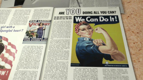
Who was the "real" Rosie the Riveter? Ask History has the story behind this famous icon.
The German surrender during World War II was one of the most momentous events of the 20th century.
Explore nine things you may not know about “Il Duce” and his 21 years in power.

The Germans and Japanese waged small-scale campaigns of bombing, sabotage and espionage.

In 1942, what many consider the last major cavalry charge took place in the Soviet Union.

While the Battle of Midway raged, Allied fighters in the Aleutian Islands quietly captured a Japanese fighter plane that helped them win World War II.
On June 22, 1944, President Franklin D. Roosevelt signed the Servicemen's Readjustment Act, better known as the G.I. Bill, in order to help soldiers secure stability as they returned to civilian life. A broadcast aired shortly after the bill was signed describes a nation preparing to welcome World War II veterans.

As goodwill ambassador for the Earth Summit, Brazilian soccer star Edson Arantes do Nascimento, better known as Pele, discusses the importance of the upcoming summit to be held in Rio de Janeiro in June 1992 to discuss an international effort to preserve natural resources by rethinking methods of economic development.
Find out about the assault of the Japanese Center Force during World War II.
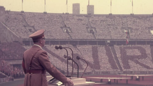
After the 1936 Olympic games, Adolf Hitler planned to build an enormous stadium.
On December 7, 1941, the Japanese sunk the USS Arizona in Pearl Harbor, killing more than 1,100 American soldiers. Did anyone aboard the Arizona survive? Find out more. From "Hero Ships."
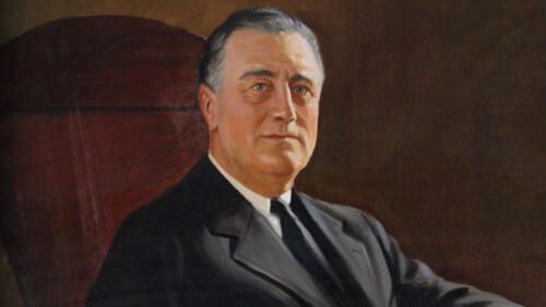
Examine President Franklin D. Roosevelt's role in World War II. Find out how he led the United States from isolationism to victory.
Decoded puzzle clue for the episode D.B. Cooper.
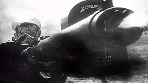
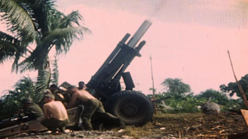
In a Mail Call video, R. Lee Ermey answers a question from Tom of Kansas, who wants to know what the biggest gun in the world is. Ermey says to answer this question you first have to define what you mean by big; for we all know that guns like Big Bertha and Anzio Annie are big, but if you are talking total weight and size of the shell, then they are not the biggest. The Gustav gun created by the Germans, takes the cake on this one with an 80cm barrel. The Germans first used this gun in World War II; it was designed to pulverize French defensive bunkers in the early days of the war.
After the D-Day invasion of France on June 6, 1944, the Allied advance is mired in the thick hedgerows of Normandy's bocage country.
On December 7, 1941, Japan launches a surprise attack on American soil at Pearl Harbor.
WWII veteran Robert Morgan was captain of the B-52 Memphis Belle during the historic 25 mission tour.
Pilots of the USS Yorktown reminisce about their epic raid on Japan.
On June 15, 1944, the U.S. launches a critical attack on Saipan in the Mariana Islands.
With the U.S. Army and Air Force at their side, Patton and his troops campaign to drive the Nazis from the Mediterranean and liberate Europe. From Patton 360.
Excerpts from an interview with Dick Winters of the 101st Airborne Division
On June 6, 1944, the Allies invade Western Europe in the largest amphibious attack in history.
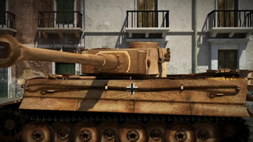
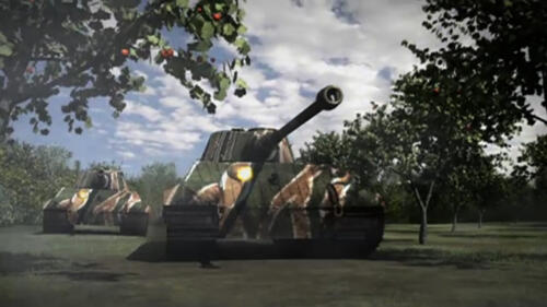
Patton's tank crews must devise new tactics in order to defeat one of the most terrified weapons of World War II--Hitler's Tiger tanks. From Patton 360.
Albert Fagler's grandfather was an Army Air Corps photographer during WWII and left behind film reels.
WWII Veteran Randy James fought the Japanese during the Battle of Iwo Jima.
Excerpts from an interview with Dick Winters of the 101st Airborne Division.

WWII veteran Samuel Hynes talks about the lasting effects of the war on his generation.
From the deserts of North Africa to the forests of Germany, Patton's army battles it out with artillery vital to winning the war. From Patton 360.
The K-25 plant in Oak Ridge, Tennessee, was built to enrich uranium for the atomic bomb.
David Keran's grandfather was an OSS agent working with the French Resistance during WWII and left behind films of his experiences.
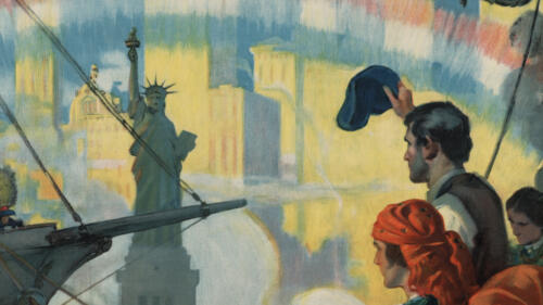
An army troop ship of over 860 refugees from Europe sails into New York Harbor. These people were victims of Nazi persecution; many of them spent long, terrible months in concentration camps.
In July 1942, the Nazi Army bombs the Soviet city of Stalingrad, launching one of the bloodiest battles in history.
The general gains fame in World War II, then infamy when he is removed from his command in the Korean War.
During WWII, Hitler's decentralized and paranoid military command structure spells disaster on the battlefield.
Excerpts from an interview with Dick Winters of the 101st Airborne Division
Franklin D. Roosevelt declares war on Japan in the wake of Pearl Harbor and warns Americans to steel themselves for difficulties ahead.
General George S. Patton chose some of the best generals in the United States army to help carry out his missions. From Patton 360.
Meet Patton's chief rivals in World War II, including Rommel, Kesselrig, Von Runstedt, Manteuffel and Balck. From Patton 360.
Los Angeles Times war correspondent Tom Treanor recounts his firsthand experience landing on the beach at Normandy on D-Day, June 6, 1944.
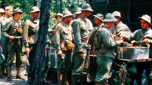
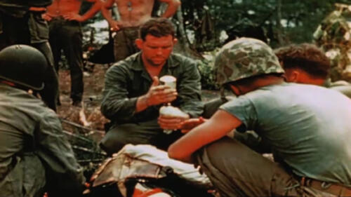
During World War II, feeding thousands of troops in enemy territory wasn't easy. Discover how soldiers carried rations into battle.
In December 1944, a major German offensive is launched against the Allies in the Ardennes Mountains region on the Western Front.

The new American Congress gathers at the Capitol to hear FDR's inspiring message of courage and hope.
What is it like to be onboard an American military ship under attack? Find out firsthand from a serviceman who was on the USS Texas when it was hit by enemy fire in the English Channel in June 1944. From Hero Ships.
Find out why the legend of George S. Patton, Jr. endures, even 60 years after his death. From Patton 360.
In this video clip of History's Mail Call, host R. Lee Ermey, along with Andy Miller of the Military Radio Collectors Club, takes a look at what kind of radios they used in World War II including the handie-talkie, walkie-talkie and TBX8 radio set.
On June 6, 1944, Allied troops invade German-occupied France and face near certain death on the beaches of Normandy.

Adolf Hitler commissioned his engineers to build a domed structure to serve as the center of the new German Capital, Germania.
Find out about the life of George S. Patton, one of America's most famous generals and an enduring legend of World War II. From Patton 360.

Senator Daniel Inouye fought to prove his American patriotism.
The Allies use double agents, code breakers and spies to undermine the German military throughout WWII, but cracking the Enigma code proves to be their greatest breakthrough.
In this video clip of History's Mail Call, host R. Lee Ermey takes a look at what kind of personal items our World War II soldiers carried. Cameras and diaries were forbidden but compact shaving kits, letters from home, magazines, prophylactic kits and other small items were common.
Take a look at the equipment paratroopers of the 82nd and 101st Airborne Divisions used on D-Day.
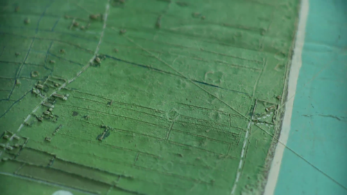
D-Day raised-relief map of Utah Beach prepared U.S. troops for the 1944 invasion of Normandy.
In a costly battle, U.S. forces assault Peleliu in the Palau Islands.
How did the Jeep come to get its name? R. Lee Ermey answers this question and looks at one of the most well-known military vehicles.
The U.S. invades Kwajalein on January 31, 1944, breaking the outer ring of the Japanese Pacific territory.
On April 1, 1945, Allied forces invade the island of Okinawa and engage the Japanese in the bloodiest battle of the Pacific War.
Take a look at the events leading to the bombing of Pearl Harbor, which prompted President Roosevelt to declare war on Japan.
On February 19, 1945, American soldiers make their first strike on the Japanese Home Islands at Iwo Jima.
WWII veteran Luther Smith flew with the all-black Tuskegee Airmen squadron.
The USS New York saw heavy action during World War II. Five decades later the battleship was rebuilt using metal from the terrorist attacks on September 11, 2001.
A look back at the day the Imperial Japanese Navy conducted a surprise military strike against the United States naval base in Hawaii.
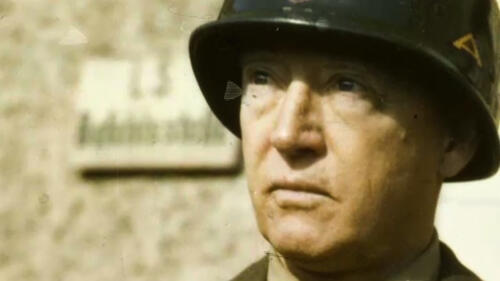
Originating from the United States, General George S. Patton's soldiers proudly fight from the deserts of North Africa to the hills of Sicily and the villages of France and Germany. From Patton 360.
Excerpts from an interview with Dick Winters of the 101st Airborne Division
The outspoken and opinionated general leads U.S. troops in both World War I and II.
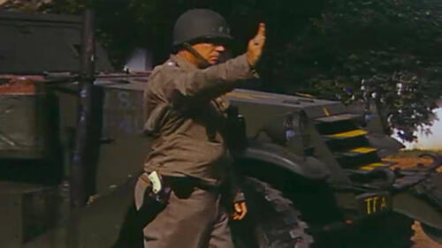
His ivory-handled gun bearing the initials G.S.P. distinguished General Patton on the battlefield and made him one of the most recognized generals in World War II. From Patton 360.
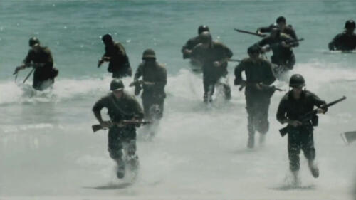
On June 6, 1944, Allied troops landed on the beaches of Normandy and turned the tides of World War II.
In August 1945, the United States dropped two atomic bombs over the Japanese cities of Hiroshima and Nagasaki. What happened to people on the fringes of the blasts?
Explore the top-secret American project to build the world's first atomic bomb.
Check out this hair-raising account of how Flying Tiger Tex Hill reacted to a Japanese KI-27 attacking his flight leader over Thailand.
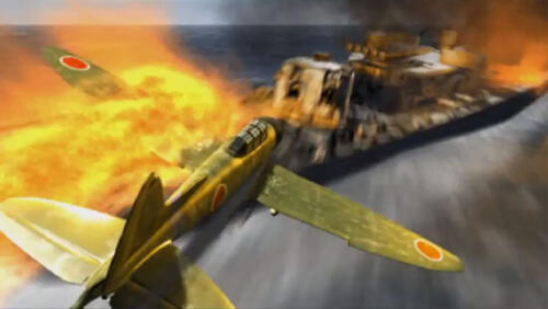
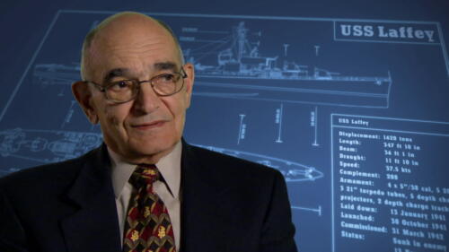
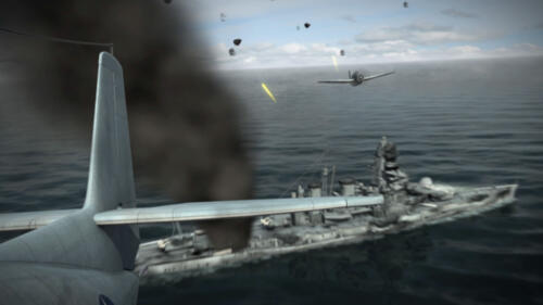
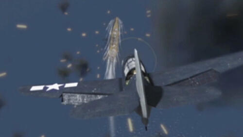
The USS Laffey engages in a heated battle against 22 kamikazes off the coast of Okinawa in the most concentrated kamikaze attack of World War II.
How close was Hitler to launching a nuclear attack against the Allies in World War II? After developing a V2 ballistic missile capable of reaching as far a New York, Hitler made nuclear development his highest priority. On December 3, 1942, the first atomic pile went critical, and maintained a self-contained nuclear chain reaction. This was key in the development of an atomic bomb; however, the Manhattan Project was far from reaching its goals. The Germans had no long range bomber so they moved ahead in ballistic missile development. In May 1943, the A4 missile was successfully demonstrated, making Hitler's highest priority nuclear development. Because nerve agents like tabun and sarin were unreliable, nuclear weapons were the best alternative. Paul Harteck created a low energy nuclear reactor, a major step in Hitler's plans. When the warhead landed, a cloud of dust would arise, spreading death over the area for weeks. If plutonium was put into the warhead, the land would be contaminated for years. However, Hitler's plans failed with the invasion of Normandy, making this the least known close call in modern history.
After WWII, soldiers went about the difficult process of readjusting to civilian life.
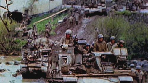
Armored tanks provided extra firepower and mobility during World War II.
American soldiers used military-issue shovels for many tasks in World War II.

Find out more about the distinguished squad of all-Black flyers.

Explore little-known facts about the "date which will live in infamy."

Explore the lives of 10 daring and intriguing covert agents you might not have read about in history books.

Told he wouldn’t live past 50, the oldest known American survivor of the brutal Bataan Death March during World War II, died Sunday at 105.

Japan has vowed to locate the remains of an estimated 12,000 troops still missing since the Battle of Iwo Jima.
Adolf Hitler may have had Jewish and African ancestors, according to a recent DNA study by Belgian researchers.

The G.I. Bill— officially known as the Servicemen’s Readjustment Act of 1944—was created to help veterans of World War II. It established hospitals, made low-interest mortgages available and granted stipends covering tuition and expenses for veterans attending college or trade schools.

Rosie the Riveter was the star of a campaign aimed at recruiting female workers for defense industries during World War II. Artist Normal Rockwell's cover image of Rosie, made in 1943, became, perhaps the most iconic image of working women.

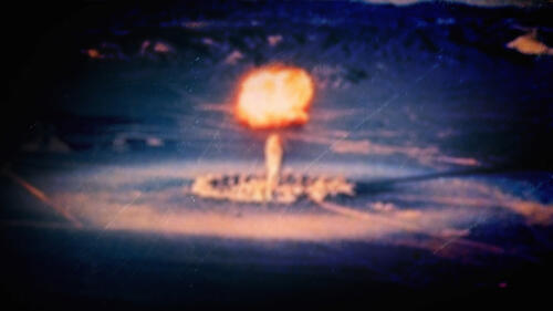
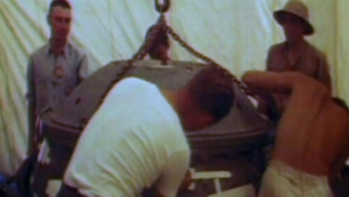
The Trinity Test was the first detonation of an atomic bomb by scientists at a test site of the U.S. Air Force base at Alamogordo, New Mexico, in 1945.

Joseph Goebbels (1897-1945), was the Reich Minister of Propaganda of Nazi Germany. He was charged with presenting Hitler to the public in the most favorable light, regulating the content of all German media and fomenting anti-Semitism. On May 1, 1945, the day after Hitler committed suicide, Goebbels and his wife poisoned their six children and then killed themselves.

On the home front during World War II, life in the U.S. was changed by rationing, defense production, women’s jobs and popular radio and movie entertainment.

American women served in World War II in many roles: as pilots, nurses, civil service employees, and in many home-front jobs that were formerly denied to them.
The Nuremberg trials were a series of 13 trials carried out in Nuremberg, Germany, between 1945 and 1949 to try those accused of Nazi war crimes. The defendants, who included Nazi Party officials and high-ranking military officers, etc., were indicted on such charges as crimes against peace and crimes against humanity.

The “Schutzstaffel” (German for “protective echelon”) was founded in 1925 and served as Nazi Party leader Adolf Hitler’s (1889-1945) personal bodyguards. They later became one of the most powerful and feared organizations in all of Nazi Germany.

The Marshall Plan, also known as the European Recovery Program, was a U.S. program providing aid to Western Europe following the devastation of World War II.

The Italian Campaign, from July 10, 1943, to May 2, 1945, was a series of Allied beach landings and land battles from Sicily and southern Italy up the Italian mainland toward Nazi Germany during World War II.

The Allies Target Italy When the Allies won the North African Campaign on May 13, 1943, a quarter-million German and Italian troops surrendered at Tunisia, on the north coast of Africa. With the huge Allied army and navy in the southern Mediterranean no...

On August 6, 1945, during World War II (1939-45), an American B-29 bomber dropped the world’s first deployed atomic bomb over the Japanese city of Hiroshima, immediately killing 80,000 people. Three days later, a second bomb was dropped on Nagasaki, killing an estimated 40,000 people.

A Controversial Attack By the end of February 1944, Allied forces had gained control of the Marshall Islands in the western Pacific Ocean and moved on to the Marianas, where 20,000 U.S. troops–by far the largest force used in a Pacific operation thus fa...

Leading Up to Battle During the first few months after World War II expanded into the Pacific in late 1941, Japan scored victory after victory, taking control of islands ranging from the Aleutians (off the coast of Alaska) to the Philippines. In January...

The Marshall Islands and the U.S. “Island-Hopping” Strategy The peace settlement that ended the First World War gave Japan a mandate over the Marshall Islands in the western Pacific Ocean. Kwajalein, in the Ralik (western) chain of the Marshalls, was th...

The Battle of Tarawa stemmed from the difficult but successful attempt by U.S. forces to take the Japanese-held island of Betio in the Tarawa Atoll in 1943.

U.S. Commanders Focus on Taking Saipan In the spring of 1944, U.S. forces involved in the Pacific Campaign invaded Japanese-held islands in the central Pacific Ocean along a path toward Japan. An armada of 535 U.S. ships with 127,000 troops, including 7...

World War II's Battle of Attu was waged between American and Japanese forces for control of the Japanese-occupied Alaskan Island in May 1943.
Japan Seizes American Soil In June 1942, six months after the Japanese attack at Pearl Harbor, Hawaii, that drew the U.S. into World War II, the Japanese targeted the Aleutians, an American-owned chain of remote, sparsely inhabited, volcanic islands ext...

The Battle of Britain in World War II, between Britain’s Royal Air Force and Nazi Germany’s Luftwaffe, was the first battle in history fought solely in the air.

The Tuskegee Airmen were the first black military aviators in the U.S. Army Air Corps (AAC), a precursor of the U.S. Air Force. Trained at the Tuskegee Army Air Field in Alabama, they flew more than 15,000 individual missions in Europe and North Africa during World War II.

The Battle of Stalingrad was a brutal military campaign between Russian forces and those of Nazi Germany and the Axis powers during World War II. Germany's defeat in the battle marked a turning point of the war in favor of the Allies.

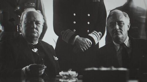
At the 1945 Potsdam Conference, U.S. President Truman, Soviet leader Stalin and British Prime Minister Churchill negotiated political goals after World War II.

The Nazi Party was a political organization that ruled Germany through murderous, totalitarian means from 1933 to 1945 under the dictatorship of Adolf Hitler.

The Molotov-Ribbentrop Pact was a non-aggression pact signed in 1939 by former enemies Nazi Germany and the Soviet Union shortly before World War II broke out.

July Plot: Background Since the late 1930s, there had been repeated attempts by various groups in the German resistance to assassinate Adolf Hitler and overthrow the Nazis. As time went on, Hitler became increasingly suspicious and more heavily guarded,...

Jimmy Doolittle: Early Years James Harold “Jimmy” Doolittle was born in Alameda, California, but spent much of his childhood in western Alaska. His father, Frank, was a gold prospector and carpenter in Nome, where young Jimmy learned to fight bullies an...

Hirohito was emperor of Japan from 1926 until his death in 1989. He oversaw the country during World War II and the bombings at Hiroshima and Nagasaki.

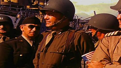
George S. Patton (1885-1945) was a high-ranking WWII general, who led the U.S. 7th Army in its invasion of Sicily and northern France in the summer of 1944. Patton began his military career leading cavalry troops against Mexican forces and became the first officer assigned to the new U.S. Army Tank Corps during World War I.

Francisco Franco (1892-1975) ruled Spain as a military dictator from 1939 until his death. He rose to power during the bloody Spanish Civil War when his Nationalist forces overthrew the democratically elected Second Republic. Adopting the title of “El Caudillo” (The Leader), Franco persecuted political opponents and censured the media, among other abuses. Upon his death the country transitioned to democracy.

In the Bataan Death March of World War II, 75,000 Filipino and U.S. troops made a hellish 65-mile march to prison camps, but about 17,000 were killed en route.
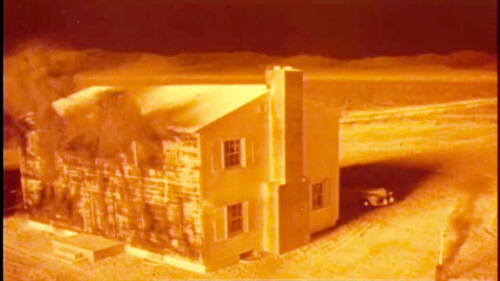
The British/American bombing of Dresden took place between February 13-15, 1945 during the final months of World War II. The bombing was controversial because Dresden—a historic city located in eastern Germany—was neither important to German wartime production nor a major industrial center.
The Atlantic Charter is considered one of the first key steps toward the establishment of the United Nations. In August 1941, the U.S. and Great Britain set out a vision for the postwar world. In January 1942, a group of 26 Allied nations pledged their support for this declaration.

Warsaw Ghetto Shortly after the German invasion of Poland in September 1939, more than 400,000 Jews in Warsaw, the capital city, were confined to an area of the city that was little more than 1 square mile. In November 1940, this Jewish ghetto was seale...

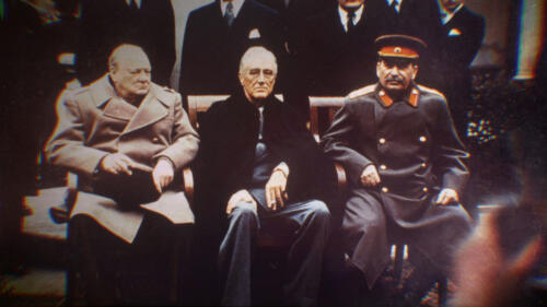
The Yalta Conference of 1945 was an historic meeting of three World War II allies: U.S. President Roosevelt, British Prime Minister Churchill and Soviet Premier Stalin.

World War II was a global war that lasted from 1939 to 1945. Rising to power in an unstable Germany, Adolf Hitler and his National Socialist (Nazi Party) rearmed the nation and signed treaties with Italy and Japan to further his ambitions of world domination. Hitler’s invasion of Poland drove Great Britain and France to declare war on Germany, and World War II had begun. The majority of the world's countries eventually formed two opposing alliances: the Allies and the Axis.

General Tôjô Hideki (1884-1948) served as Japan’s prime minister during most of World War II. At the end of the war, he was sentenced to death for war crimes.
Erwin Rommel was a German army officer who rose to the rank of field marshal and earned fame at home and abroad for his leadership of Germany’s Afrika Korps in North Africa during World War II. Nicknamed “the Desert Fox,” Rommel also commanded German defenses against the Allied invasion of northern France.
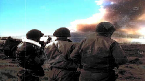
Pearl Harbor is a U.S. naval base near Honolulu, Hawaii, that was the scene of a devastating surprise attack by Japanese forces on December 7, 1941. The day after the attack, President Franklin D. Roosevelt asked Congress to declare war on Japan.

In the Battle of Okinawa, the last major battle of World War II and one of the deadliest, U.S. troops overran Japanese resistance to take the island of Okinawa.

Operation Barbarossa, Adolf Hitler’s codename for Nazi Germany’s massive 1941 invasion of the Soviet Union during World War II, was ultimately a costly failure.

Benito Mussolini, an Italian political leader who allied himself with Adolf Hitler during World War II, became the fascist dictator of Italy from 1925-1945.

The Battle of Midway was an epic WWII clash between the U.S. Navy and the Imperial Japanese Navy that played out six months after the attack on Pearl Harbor. The U.S. Navy’s decisive victory in the air-sea battle (June 3-6, 1942) dashed Japan’s hopes of neutralizing the United States as a naval power and effectively turned the tide of World War II in the Pacific.

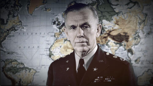
George C. Marshall (1880-1959) was one of the most decorated military leaders in American history. A graduate of the Virginia Military Institute, he was a World War I staff officer and later became assistant commandant at the U.S. Infantry School. Named...

The Maginot Line, an array of defenses that France built along its border with Germany to prevent a German invasion, failed completely during World War II.
Douglas MacArthur was a five-star American U.S. general who commanded the Pacific forces in World War II, oversaw the occupation of Japan and led U.N. forces in the Korean War.

The Lend-Lease Act of 1941 allowed the U.S. government to lend or lease war supplies to any nation vital to U.S. defense, such as Britain during World War II.

Germany’s Epic Defeat at the Battle of Stalingrad By June 1942, Hitler had advanced into the Soviet Union and hoped to easily take the strategic city of Stalingrad, the namesake city of Soviet leader Joseph Stalin. But Stalin rallied both Russian troops...

Japanese internment camps were established during World War II by President Franklin D. Roosevelt through his Executive Order 9066. From 1942 to 1945, it was the policy of the U.S. government that people of Japanese descent, including U.S. citizens, be incarcerated.

The Battle of Iwo Jima (February 19 – March 26, 1945) was an epic military campaign between U.S. Marines and the Imperial Army of Japan during World War II. American forces succeeded in securing the island, which was considered to have great tactical importance for its airfields.

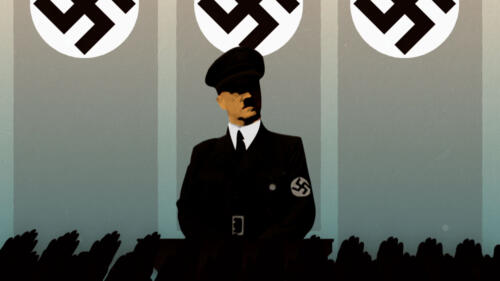
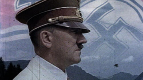
Adolf Hitler was leader of the Nazi Party who rose to become dictator of Germany. Hitler used his power to orchestrate the deaths of 6 million Jews and millions of others during World War II.

Although most Americans, preoccupied with the war, remained unaware of the terrible plight of European Jewry at the time, American and British Jewish organizations pressured their governments to take action as they heard early reports about the Holocaust.

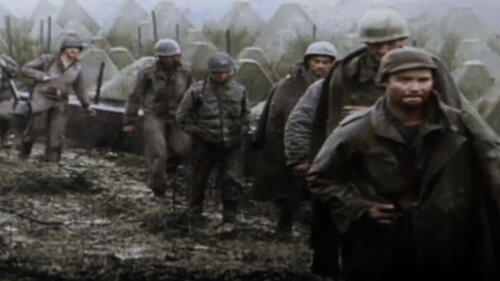
Codenamed Operation Overlord, the invasion began on June 6, 1944, also known as D-Day, when some 156,000 American, British and Canadian forces landed on five beaches along the heavily fortified coast of France’s Normandy region during World War II. The operation was one of the largest amphibious military assaults in history and has been called the beginning of the end of war in Europe.

Omar N. Bradley was a senior U.S. Army officer who served as field commander of American soldiers during the Allied invasion of Normandy on D-Day and led Allied troops as they drove into Germany near the end of World War II.

The Battle of the Bulge took place in December 1944, after Adolf Hitler launched a surprise blitzkrieg against Allied Forces in northwest Europe. Caught off-guard, American units fought to stem the German advance. As the Germans pushed through American defenses, the front line took on the appearance of a large bulge, giving rise to the battle’s name.

Blitzkrieg, or “lightning war,” is a method of offensive warfare designed to strike a swift, focused blow at an enemy using highly mobile ground and air forces.

From Pearl Harbor to Hiroshima and Nagasaki Japan’s devastating surprise aerial attack on the U.S. naval base at Pearl Harbor on Oahu, Hawaii, on December 7, 1941, capped a decade of deteriorating relations between Japan and the United States and led to...


